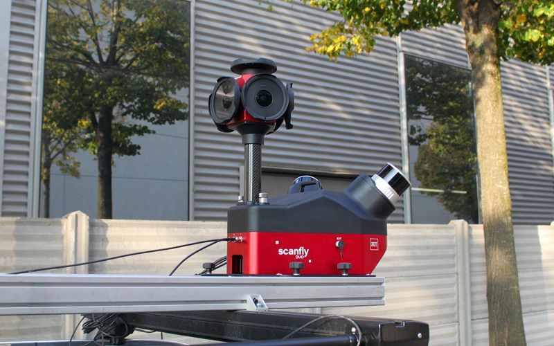
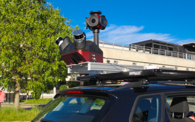
Designed to be operated in the field by a single operator, Scanfly DUO is the ideal tool for digitizing metropolitan areas and infrastructure assets. With the help of the SLAM algorithm and the twin multi-channel Lidar heads, the environment can be precisely modelled with reduced shadows and increased accuracy in GNSS-diminished areas.
START DIGITIZING YOUR ROAD TODAY
▪ Compact and versatile mobile mapper
▪ Dual multi-channel LiDAR
▪ High-resolution 360° imagery
▪ Single-user operations
No Videos uploaded for this product.